NASA and IBM released a lunar AI foundation model on September 10, giving researchers a reusable tool for investigating the Moon. Its most consequential promise is a better way to decide what deserves closer study. Reading the launch materials alongside the model documentation reveals three different thresholds: finding a pattern, establishing what that pattern means, and deciding whether it is reliable enough to act on.
TENS Magazine’s analysis is that the release matters most when those thresholds remain separate. A system can help organize scientific attention before it can support a mission decision. That distinction becomes especially important when the same announcement discusses crater mapping, volcanic history and possible ice resources, which involve different kinds of evidence.
A map of possibilities needs a different test
The NASA-IBM model card explicitly describes its ice-prospectivity target as a knowledge-driven map, rather than measured ice. It also says the system has not been validated for landing-site certification or hazard clearance. Those limits define the product’s scientific role more clearly than a broad claim about finding resources.
For a reader, the distinction changes the question to ask. Agreement with a reference map measures how well an AI reproduces that reference. Establishing a deposit requires evidence about the physical material. Treating the first result as the second would silently promote a useful screening tool into a discovery instrument. A strong screening result deserves follow-up, with the basis for that follow-up made explicit.
IBM’s announcement reports reduced error on ice prospectivity and describes applications across several lunar tasks. NASA’s account is more differentiated: it describes comparable performance on crater mapping and irregular mare patch segmentation, with a clearer advantage on polar ice stability estimation. The practical reading is task-specific progress, rather than one uniform leap in lunar understanding.
This suggests a straightforward editorial test for future claims: name the target, name the comparison and state what remains unmeasured. A map that helps scientists prioritize an investigation can be valuable without establishing the quantity, accessibility or usability of a resource. Keeping that boundary visible protects the meaning of the achievement.
New-looking terrain may reflect a new view
NASA describes a test using images from before and after a rocket-body impact near Einstein crater. The post-impact image was excluded from pre-training. The agency also notes that changing illumination between orbital observations can affect the visibility of smaller craters.
TENS Magazine reads these two details together. Holding out a later image makes the demonstration more informative than simply recognizing a training example. But a before-and-after comparison still needs to distinguish a changed surface from a changed view. Both questions belong in an assessment of novelty; solving one does not automatically settle the other.
The model card says illumination information is supplied as context. That design acknowledges a central difficulty in reading lunar imagery. It also makes the relevant follow-up clearer: researchers should examine where performance holds under different observing conditions, rather than treating a compelling example as evidence of universal reliability. This is an evaluation priority, not a claim that the released system has failed such a test.
Open access has more than one level
The release offers another useful comparison between ambition and implementation. NASA presents the public codebase as a resource for testing and experimentation. The NASA-IMPACT repository describes a fine-tuning and inference release and explicitly says pre-training code is not included. Its files provide model components and configurations for downstream tasks.
Those statements can coexist, but they imply different kinds of reproducibility. Researchers can work from an existing model and evaluate an adapted system without having everything needed to recreate the original training process. For an outside laboratory, the first question is therefore which experiment the release enables, followed by which parts still depend on the supplied checkpoint.
That distinction should travel with the word “open.” Access to weights, usable evaluation code and a fully reproducible training pipeline are separate capabilities. Describing the available layer precisely gives researchers a more practical starting point and prevents openness from becoming a substitute for a methods account.
The next result should connect the steps
The most useful next demonstration would trace a candidate through a complete research sequence: an AI flags it, a scientist checks the underlying observations, and additional evidence supports or rejects the interpretation. The outcome could be a confirmed finding or a well-documented false lead. Either would show how the system changes scientific work.
That is the opportunity this release creates. Faster pattern finding can move attention toward overlooked questions, while explicit limits keep the resulting claims proportionate to the evidence. The measure of progress is how effectively the model helps researchers cross each evidentiary threshold, with a visible account of what justified the next step.
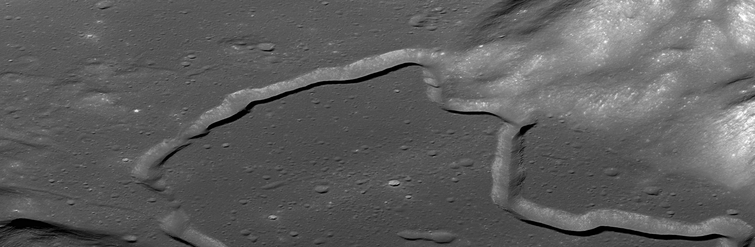
Image: Archival Lunar Reconnaissance Orbiter view of Hadley Rille; contextual lunar terrain photograph, not an AI output or a newly identified feature. Credit: NASA/GSFC/Arizona State University, via Wikimedia Commons. Public Domain. Modifications: none; original landscape file retained.